Visual Materials
Transmission corridors mapped from Bonneville and Glen Canyon Dams to Los Angeles

You might also be interested in

Map of early transmission corridors
Visual Materials
Map of early transmission corridors in Ventura county.
photCL SCE 10 - 00998

Southern California mapped utilities
Visual Materials
Southern California mapped utilities (color trans.)
photCL SCE 07 - 02347

Map of California showing the early transmission line corridors and powerplants belonging to The Nevada-
Visual Materials
Map of California showing the early transmission line corridors and powerplants belonging to The Nevada-California Electric Corp..
photCL SCE 07 - 00038
Map showing early transmission line corridors in southern California for Southern Sierras Power Co
Visual Materials
Map showing early transmission line corridors in southern California for Southern Sierras Power Co., Pacific Light & Power, and Southern California Edison.
photCL SCE 07 - 02447
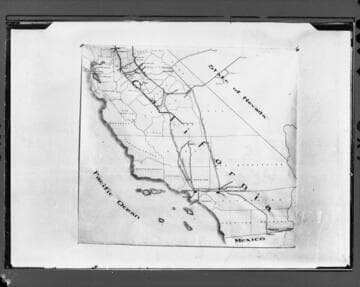
Partial map of California showing the early transmission line corridors
Visual Materials
Partial map of California showing the early transmission line corridors belonging to Pacific Light and Power, Pacific Gas & Electric, Southern California Edison, Southern Sierras Power Co., San Joaquin Light & Power, Sierra & San Francisco Power and Western States Gas & Electric. No number originally assigned by Cal. Electric and - no documentation included.
photCL SCE 07 - 00037

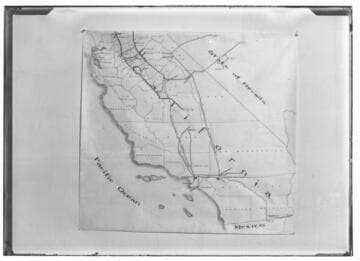
Map of Southern California showing the early transmission line corridors belonging to Pacific Light and Power, Southern California Edison and Southern Sierras Power Co
Visual Materials
Map of Southern California showing the early transmission line corridors belonging to Pacific Light and Power, Southern California Edison and Southern Sierras Power Co. before the time of Edison's acquisition of PL&P. No number originally assigned by Cal. Electric and - no documentation included.
photCL SCE 07 - 00036