Visual Materials
C1.3 - Maps

You might also be interested in
C1.3 - Maps
Visual Materials
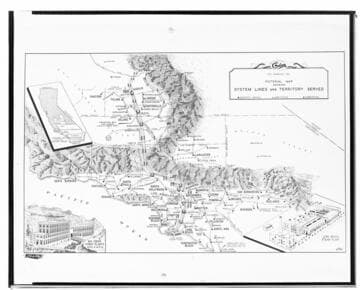
C1.3 - Maps - Map of Edison Transmission Lines and System for Annual Report. [drawing of Powerhouse 2 & 2A is shown as a mirror image]
photCL SCE 02 - 16606

C1.3 - Maps
Visual Materials
C1.3 - Maps - Map of SCE Co.'s Principal Power Lines (for Annual Report)
photCL SCE 02 - 11115

C1.3 - Maps
Visual Materials
C1.3 - Maps - California display map for Annual Report.
photCL SCE 02 - 14968

C1.3 - Maps
Visual Materials
C1.3 - Maps - Copy of map showing SCE Transmission System.
photCL SCE 02 - 03601

C1.3 - Maps
Visual Materials
C1.3 - Maps - California display map for Annual Report. (red filter).
photCL SCE 02 - 14969

C1.3 - Maps
Visual Materials
C1.3 - Maps - A map of the territory served by the San Joaquin Light and Power Corporation. The map was made by J.G. White and Co.
photCL SCE 02 - 00453