Manuscripts
Asgard the Demon Hunter; or, Le Démon à la Chasse

You might also be interested in
Image not available
Asgard the Demon Hunter; or, Le Démon à la Chasse. Burletta spectacle, 1 act. Jane M. Scott
Manuscripts
No application. Prod. Sans Pareil, Nov. 17, 1812. MS: endorsed, by Larpent, Sans Pareil, Nov. 5.
LA 1741

Remorse
Manuscripts
A tragedy which was a revision of Coleridge's play Osorio. It features the aristocratic hero, Don Alvar.
mssLA 1753

The Benevolent Planters
Manuscripts
Used as a pro-slavery tool this play features two lovers who are transported from Africa to the West Indies as slaves. They are separated then reunited on the plantation. The suggestion is that their lives are improved by being on the plantation and that the 'benevolent planters' of the title care for the slaves and have their best interests at heart.
mssLA 839
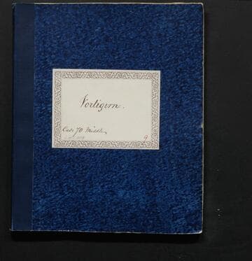
Vortigern
Manuscripts
A play which was a Shakespearean hoax written by William Henry Ireland, who had claimed to have been the rightful descendant to one of Shakespeare's plays. In the play, King of the Britons Constantius offers half his crown to his adviser Vortigern.
mssLA 1110
Image not available
Partie des Côtes de Labrador Depuis le Cap Charles à la Baye de Sandwich
Visual Materials
Kashnor notes, "A scarce map, issued for the use of French navigators during the Revolution." This map appears to be half of the RLIN record cited. Inset Riviere de Uo.. Relief: no. Graphic Scale: Leagues. Projection: Plane. Watermark: Crowned Maltese cross lettering. Printing Process: Copper engraving. Other Features: Sub-maps. Verso Text: MS note: 104.
105:104 M
Image not available
Carte General de la Caroline Dresse sur les Memoires le plus Nouveaux Par le Sieua S
Visual Materials
Kashnor notes, "with inset map of Cooper and Ashley Rivers with Charlestown, which locates neaqrly forty settlers, a rare map." Kashnor dates as [1700]. Submap of Ashley and Cooper Rivers with listing of settlers. Map trimmed right side within neatline.. Prime meridian: Ferro. Relief: pictorial. Graphic Scale: Leagues. Projection: Mercator. Printing Process: Copper engraving. Other Features: Sub-maps. Verso Text: MS note: 361.
093:361 M