Manuscripts
Los Angeles County public lands : T. 3-4 N. R. 15 W. S.B.M

You might also be interested in
Los Angeles County public lands : T. 4 N. R.13 W. S.B.M., Soledad Canyon
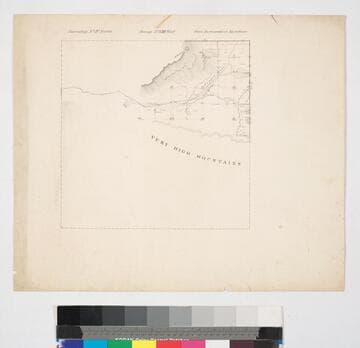
Manuscripts
Showing structures, extensive surface detail, (Copper Mine, Mt. Parkinson, dry arroyo, ravines, Very High Mountains) ; acreages, parcel numbers. Title supplied by cataloger.
mssSolano SR_Map_0780

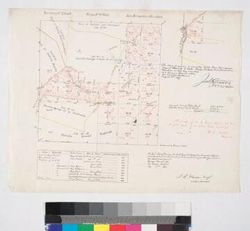
Elizabeth Lake : Public lands T.7 N. R.14 W. S.B.M
Manuscripts
On printed township grid showing structures, surface detail, notes re: parcel owners & corresponding courses. Paper watermark: Hurlbut Paper Co. Title supplied by cataloger.
mssSolano SR_Map_0755.01
Los Angeles County public lands : T.2 S. R. 14W., S.B.M
Manuscripts
Showing parts of Ranchos Ballona, Rincon de Bueyes, Aguaje de la Centinela, Sausal Redondo, Las Cienegas; public lands. showing acreages and surface detail, based on surveys of 1853-1871, with diagram of T.2 S.R. 14 W.; with color highlighting, section numbers, courses, distances, lots of notations in red ink; table of surveying history; minor surface details. Title supplied by cataloger.
mssSolano SR_Map_0766
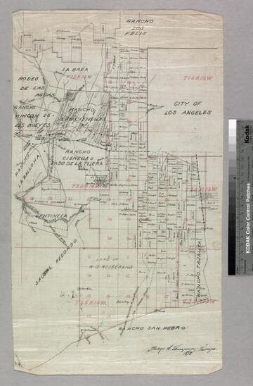
Los Angeles County public lands : T. 1S. R. 13-14W., T.2S. R. 13-14W., and T.3S. R. 13-14W. S.B.M
Manuscripts
Shows Ranchos Aguaje de Centinela, Rodeo de las Aguas, La Brea, Los Felis, Las Cienegas, Rincon de Los Bueyes, La Ballona, Cienega Paso de la Tijera, Sausal Redondo, San Pedro, Tajauta; City of Los Angeles, Land of W.S. Rosecrans. Showing structures, townships, section numbers, surface detail, parcel owners; color highlighting. Title supplied by cataloger.
mssSolano SR_Map_0769
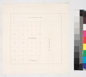
Los Angeles County public lands : T.2S. R. 13W. S.B.M
Manuscripts
Bordered by Ranchos San Antonio & Tajauta, Los Angeles City. Hand drawn township grid in red & black inks; shows 1876 charter boundary. Title supplied by cataloger.
mssSolano SR_Map_0768
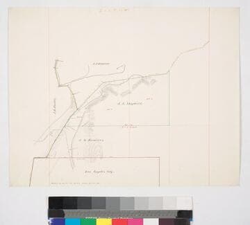
Los Angeles County public lands : J.S. Shepherd and J.M. Ramirez parcels
Manuscripts
Bordered by City of Los Angeles. Highland Park along the Arroyo Seco, sec. 12, T. 1S. R. 13W. S.B.M., showing structures, surface details - extensive hachures, vegetation; parcel owners; color highlighting. Title supplied by cataloger.
mssSolano SR_Map_0770