Visual Materials
"Malibu" No. of Santa Monica

You might also be interested in

"Malibu" North of Santa Monica, Cal
Visual Materials
Landscape view of the coastline and the Beach Road (which later became part of the Pacific Coast Highway) in Malibu California, with La Costa Beach in the foreground and the Malibu Pier in the distance.
photCL_555_01_711

Highway 101 - Midway Santa Monica to Oxnard, Calif
Visual Materials
Image of the coastline looking south towards Point Dume from the Roosevelt Highway (later Pacific Coast Highway), and beach houses along Broad Beach near Trancas Canyon at Rancho Malibu, California, with the Malibu Trading Post, Cafe, cafe, Gilmore gas station, and a "Malibu Beaches" billboard visible.
photCL_555_06_2042
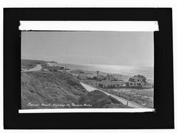
Trancas Canyon, Highway 101, Rancho Malibu
Visual Materials
Image of the coastline looking south towards Point Dume, Roosevelt Highway (later Pacific Coast Highway), and beach houses along Broad Beach near Trancas Canyon at Rancho Malibu, California, with a cafe and billboard visible.
photCL_555_06_2013

Santa Monica Yacht harbor
Visual Materials
Image of the Santa Monica Yacht harbor with people standing at the end of the Santa Monica Pier, in Santa Monica, California, with automobiles parked on the pier, including one with labels "Pioneer Public Market, Santa Monica" and "Baby Beef," and boats in the water. The iIramar Beach Hotel and the California Incline are visible on the coastline in the distance.
photCL_555_01_1502b

Buildings along beach, Santa Monica
Visual Materials
Image of beach houses along the boardwalk, with Cafe Nat Goodwin on Crystal Pier and Ocean Park Pier (with roller coasters) in the distance, in Santa Monica, California. A sign for "Kensington Terrace, Residents Only ..." visible along road at left.
photCL_555_09_97

Santa Monica Bay
Visual Materials
Elevated view of the Roosevelt Highway (later Pacific Coast Highway), Santa Monica Bay, and coastline with the Lighthouse Bathhouse on the beach next to the remains of the Long Wharf stone jetty in Pacific Palisades, California. The Santa Monica Pier can be seen in the distance at upper left center. A sign for "Huntington Palisades" is seen at left edge of image.
photCL_555_01_1219